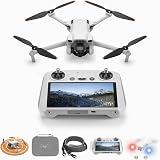
The accompanying video beautifully showcases the capabilities of a large-scale mapping fixed-wing drone, specifically highlighting the IG Drones Delta 400. This advanced Unmanned Aerial Vehicle (UAV) is meticulously engineered for comprehensive survey, mapping, and inspection tasks across vast geographical areas, representing a significant leap in geospatial data acquisition technologies.
The Undeniable Advantages of Fixed-Wing Drones for Aerial Surveys
Fixed-wing drones offer distinct operational benefits compared to multi-rotor counterparts, particularly when addressing extensive projects. Their aerodynamic design allows for much longer flight times and significantly greater range, which translates directly into enhanced efficiency for large-scale operations. For instance, a typical fixed-wing drone can cover up to 500-1000 acres in a single flight, whereas multi-rotor drones are often limited to smaller areas, typically ranging from 50-100 acres per flight. This efficiency gain dramatically reduces project timelines and associated labor costs.
Moreover, fixed-wing drones maintain consistent flight patterns at higher altitudes and speeds, capturing uniform data across expansive landscapes. This capability is critical for applications demanding broad coverage and minimal distortion. While multi-rotor drones excel in vertical take-off and landing (VTOL) and hovering for detailed inspections, their endurance constraints make them less suitable for large area mapping. In contrast, the sustained flight of fixed-wing models ensures that a single platform can manage extensive mapping missions efficiently.
Optimizing Large-Scale Mapping with Advanced Drone Technology
Effective large-scale mapping hinges upon the ability to collect high-resolution imagery and precise geospatial data consistently. Fixed-wing drones are typically equipped with advanced sensors, including high-resolution RGB cameras, multispectral cameras, and even LiDAR systems, enabling a diverse range of data collection needs. The integration of RTK (Real-Time Kinematic) or PPK (Post-Processed Kinematic) GPS technology on these platforms is paramount; these systems correct for positioning errors in real-time or post-flight, achieving centimeter-level accuracy without requiring numerous ground control points. Research indicates that using RTK/PPK drones can reduce the need for ground control points by up to 80%, substantially accelerating field operations and data processing.
Payload capacity is another crucial factor in selecting a drone for specialized mapping projects. Larger fixed-wing drones can carry heavier and more sophisticated sensors, expanding their utility for various industrial applications. For instance, a drone capable of carrying both an RGB camera and a thermal camera simultaneously provides comprehensive insights for environmental monitoring or infrastructure assessments. Such versatility makes the investment in a robust fixed-wing drone particularly appealing for organizations with diverse data acquisition requirements.
Introducing the IG Drones Delta 400 Advantage
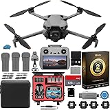
The IG Drones Delta 400 stands out as a premier fixed-wing drone, specifically designed to meet the rigorous demands of industrial large-scale mapping and inspection within the Indian market and beyond. Its robust construction and intelligent design enable extended flight durations, facilitating the survey of vast territories with exceptional precision. The Delta 400’s aerodynamic profile minimizes energy consumption, allowing it to remain airborne for considerably longer periods than many competing models.
This drone integrates state-of-the-art navigation and data acquisition systems, ensuring reliable performance even in challenging environmental conditions. Operators benefit from user-friendly flight planning software, which simplifies complex mission setups and automates flight paths. The Delta 400’s resilience and advanced features position it as a critical tool for professionals seeking to enhance their geospatial data collection capabilities and deliver high-quality mapping products. Its design focuses on maximizing operational efficiency while maintaining superior data integrity, which is essential for critical infrastructure projects.
Key Features and Specifications Enhancing Performance
- **Extended Endurance:** Capable of flights lasting up to 120 minutes, allowing for extensive area coverage in a single mission.
- **High-Resolution Imaging:** Equipped with advanced camera systems capturing imagery with ground sample distance (GSD) as fine as 1-2 cm per pixel.
- **RTK/PPK Integration:** Ensures precise georeferencing, leading to highly accurate maps and 3D models.
- **Robust Design:** Built with durable materials to withstand various weather conditions and operational demands, enhancing operational safety.
- **Autonomous Flight Capabilities:** Advanced autopilot systems allow for pre-programmed flight paths, reducing manual intervention and increasing mission repeatability.
- **Interchangeable Payloads:** Supports various sensor options, including multispectral, thermal, and LiDAR, for diverse application requirements.
Diverse Applications of Drone Mapping and Inspection
The utility of fixed-wing drones like the IG Drones Delta 400 extends across numerous sectors, revolutionizing traditional survey and inspection methodologies. These platforms provide unparalleled speed and accuracy, transforming how industries collect and utilize spatial data. From urban planning to environmental conservation, the possibilities are vast and continually expanding.
Surveying and Land Management
For land surveying, drone technology drastically reduces the time and cost associated with conventional methods. High-resolution orthomosaic maps, digital elevation models (DEMs), and 3D models are generated rapidly, providing crucial data for cadastral surveys, property assessments, and topographic mapping. Recent studies have demonstrated that drone surveys can complete projects up to 10 times faster than traditional ground-based methods, achieving accuracy levels comparable to or exceeding established standards.
Construction and Infrastructure Development
In construction, fixed-wing drones monitor site progress, manage stockpiles, and perform volumetric calculations with remarkable efficiency. Contractors can track changes over time, identify potential issues early, and ensure project adherence to design specifications. Drone-based inspections of critical infrastructure such as roads, railways, and power lines also identify defects or wear much faster and safer than manual inspections. For example, a major infrastructure project involving a 100 km highway can be mapped and inspected in a fraction of the time, reducing operational risk and labor costs by an estimated 30-40%.
Agriculture and Environmental Monitoring
Precision agriculture greatly benefits from multispectral imaging capabilities of drones, allowing farmers to assess crop health, detect irrigation issues, and optimize fertilizer application. This leads to higher yields and more sustainable farming practices. Environmental agencies employ these drones for monitoring deforestation, wildlife habitats, and changes in water bodies. According to a report, drone usage in agriculture is projected to increase by over 20% annually, driven by the need for data-driven decision-making to address global food security challenges.
Mining and Resource Management
Mining operations utilize drones for volumetric analysis of pits and stockpiles, enhancing efficiency and safety by minimizing human exposure to hazardous areas. They also assist in geological mapping and identifying potential exploration sites. The ability to quickly generate accurate 3D models of open-pit mines helps in planning extraction strategies and ensuring regulatory compliance. Furthermore, the use of drones has been shown to reduce the surveying time for a typical mine site by 75%, allowing for more frequent and comprehensive updates.
Ensuring Data Accuracy and Reliability
The true value of drone mapping lies not just in data collection speed but also in the accuracy and reliability of the output. The IG Drones Delta 400, through its integrated RTK/PPK technology and stable flight performance, guarantees high-fidelity data suitable for critical decision-making. These precise georeferencing capabilities minimize errors during the photogrammetric process, ensuring that the generated maps and models accurately reflect real-world conditions. High-quality data prevents costly rework and provides a dependable foundation for analysis.
Post-processing software plays a vital role in transforming raw drone data into actionable intelligence. This software applies complex algorithms to stitch images together, create dense point clouds, and generate various deliverables such as orthomosaic maps, digital surface models (DSMs), and contour maps. Effective data management and analysis tools empower professionals to extract meaningful insights from the vast amounts of information collected by a sophisticated large-scale mapping fixed-wing drone like the IG Drones Delta 400.
Surveying Your Questions on the IG Drones Delta 400
What is the IG Drones Delta 400?
The IG Drones Delta 400 is an advanced fixed-wing drone specifically designed for large-scale survey, mapping, and inspection tasks. It is highlighted as India’s best for professional aerial data collection over vast areas.
What is a fixed-wing drone and how is it different from other drones?
A fixed-wing drone has an aerodynamic design similar to an airplane. Unlike multi-rotor drones, it is built for much longer flight times and greater range, making it ideal for covering very large geographical areas efficiently.
Why are fixed-wing drones better for large mapping projects?
Fixed-wing drones are better for large mapping projects because they can cover significantly larger areas in a single flight, often hundreds of acres, due to their extended endurance and range. This efficiency reduces project timelines and costs.
How does the IG Drones Delta 400 ensure accurate maps?
The IG Drones Delta 400 ensures accurate maps by integrating advanced sensors with RTK/PPK (Real-Time Kinematic/Post-Processed Kinematic) GPS technology. This technology corrects for positioning errors, achieving centimeter-level accuracy without needing many ground control points.